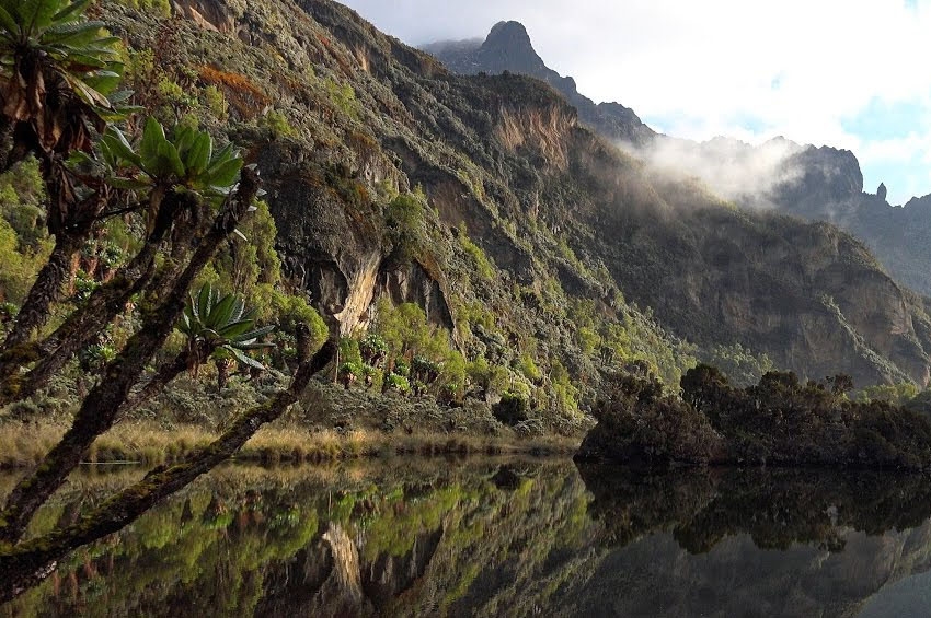
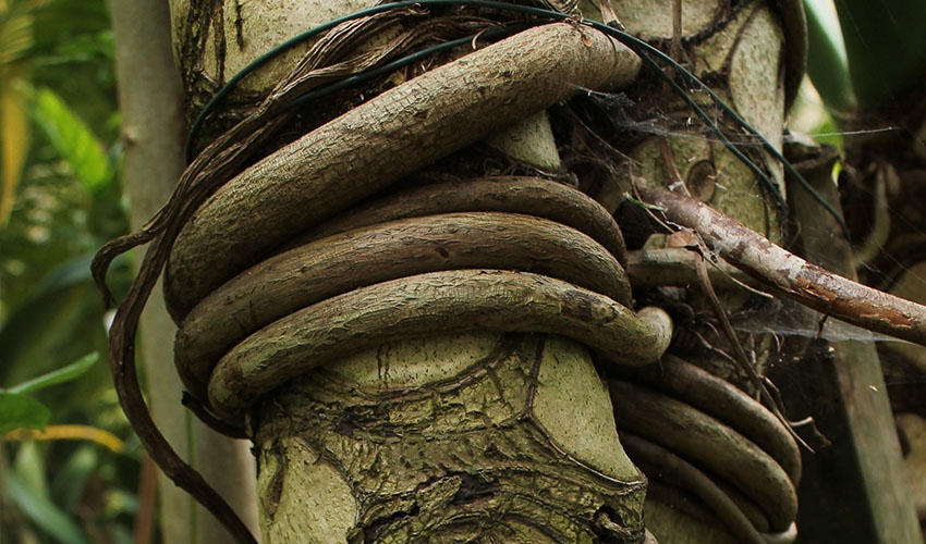
From the nethermost, fresh creeks and streams spout and run full. The brooks curl and gurgle in hypotonic symphony through dense boughs, under forest floor where orange spills of sunrise hardly touch. The forest air tastes like a cocktail of magnolia, mint, honeysuckle and vanilla, with abundant scent of moss. The cold tendrils of air provoke no scant goosebumps.A tribe of primeval trees with great arms sway with the wind like nature’s silent dance.
They are clothed in the green of every taste and none. Together with unheard cadences of birds, cheeky laughter of hyenas, hisses and seethe of fanged serpents. Together with elephant trumpets and primal grunts. Together with the howl, growl, the scowl and roar of lions, and dying shrieks and moans, of prey. Together with whistles of the wind, peals of thunder, dazzles of lightning and rainbow freckled showers, the Aberdare is alive with many a soul pulsating day and night.
The Aberdare is a ‘planet’ of waterfalls. Waters tumble down beautifully and brutally, from mighty misty heights, as if being poured from massive pails that never empty, spraying the deep green-dark below. UNESCO (2010) lists three waterfalls: Karuru falls and Gura falls which plunges a misty pool from the opposite side; while Chania falls and Gura falls cascade into the yawning mouth of the Queen's Cave.
When dark, heavy clouds are not hanging low, when rains are not weeping over the ranges, the Mau escarpments rear their craggy crown afar, while Lake Naivasha is seen sprawling far below, scintillated by beams of the sun like the finest of mirrors describes (UNESCO,2010).
Abedare was originally known as Nyandarua by the native kikuyu tribe. It means ‘the drying hide’ because its contours have features akin to the folds of a hide. (https://www.paukwa.or.ke/nyandarua/)
Aberdares ranges, is the home to Mt.Oldoinyo Lesatima -“the mountain of the young bull”, which has a maximum elevation of 3,999 metres (13,120 ft) above sea-level-the third tallest peak in Kenya. The ranges are 160 km long and have an average elevation of 3,500 metres (11,480 ft), describes (HoIberg et.al: pg .27, 2010)
The Aberdare ranges constitute the easternmost wall of the Great Rift Valley (which inhabits eight lakes), to the east of Laikipia plateau- a tableland that slumber elegantly in the day - like the pillows of land.
Indigenous beliefs and the ecosystem, conservation
A mighty moss clad Mugumo has stood rooted at the very core of Aberdare National park since the haze of time. Its bark has valleys as if eons of time artistically chiseled it, rendering the tree a living sculpture. The feat of nature towers above Aberdare ranges, its massive branches spreading wide, and sways to the lyrics of the winds. It offers an idyllic repose to families of elephants and grazing herds of buffaloes and Zebras.
The Aberdare’s majesty tree habited once more than Zebras and hogs. It’s hollow and dark crevices was a secret base and ‘post-office’ for Mau Mau guerilla fighters. The commanders of two main battalions, symptathetic villagers and fighters in the wild mountains would leave each other epistles in the veil of dark-messages of triumph, of defeat and battle plans. The tree would be named Kimathi Post Office in reverence to their leader-Field Marshall Dedan Kimathi perfect hero and a man of valor. The crevices were what boxes are to post office. Through the 50’s, a time of carnage and darkness: the Age of Kenyan freedom war against the oppressive colonial rule, when the land was torn by bloodshed and the only law was the law of gory weapons, Mugumo remained a constant point of communication.
They Mau Mau fighters would scribble on a dry, softened animal hide using raw scarlet from their veins. The ‘post-office’ remained secret till the very end of war when a British soldier stumbled on it. The tree is now a protected monument which attracts hordes of visitors to Aberdare National Park (The Standard)
UNESCO (2010) states that the Queen's Caves found in Aberdares, were used by the Mau Mau fighters to preserve their meat. The Aberdare Range was named by -Joseph Thomason,a Scottish geologist and explorer who played an important part in the Scramble of Africa.
The Kenya Forest Service (KFS) divides the ecosystem into six management zones which are aligned with administrative district boundaries. KWS on its part has divided the ecosystem into four management zones (or sectors) that are largely based on ecological as well as tourism development considerations
The five distinct zones are: High Use Zone, Low Use Zone, Wilderness Activity Zone, Multiple Use Zone and Influence Zone which support acceptable land uses in the ecosystem. The land uses include tourism, biodiversity protection, and forestry and its associated uses, such as livestock grazing and plantation establishment states Aberdare ecosystem Management plan 2010-2020
Bio Diversity of the Aberdare ecosystem
Nkaegawa et.al (2012) found out that the Aberdares contain a rich diversity of vegetation. There are 778 vegetation and plant species, subspecies and varieties found in the Aberdare National Park. Hardwood trees include cedar, podo, hagenia and camphor.
UNESCO (2010) explains that Aberdare ecosystem has four vegetation zones including subalpine vegetation, xeromorphic evergreen forest, montane humid forest, and submontane forest.The ecosystem is abundant with alpine and sub-alpine flora, including species of Helichrysum spp, Senecio spp Lobelia spp, Erica spp, and tussock grasses, gives way at around 3,000 m to bamboo Arundinaria alpine and then montane rainforest (mainly Juniperus procerus-Podocarpus falcatus-Nuxia congesta forest on the western and northwestern slopes, ocotea forest on the south-east, and mixed Podocarpus latifolius forest on the east and on Kipipiri (Beentje 1990). Pockets of Hagenia forest occur in sheltered patches on the rolling moorland .
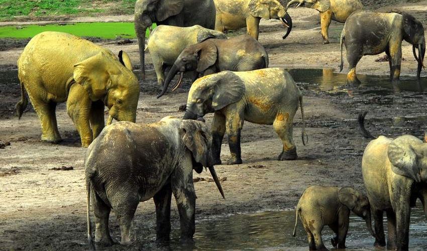
The Aberdares is home to 52 of Kenya's 67 Afro tropical Highland animal species. The rare species include the Bongo estimated at over 65 individuals in forest (KWS 2002), Leopard ,Black Rhinoceros African Elephant, (some 1,500 are resident:) and Giant Forest Hog and a population of Lions the African Golden Cat ,a rare species and Spotted Hyena, states KWS( 2005.)
Endemic small mammals include Aberdare Mole-shrew and Aberdare Mole rat .The montane viper occurs only in Aberdares here and Mt Kenya (UNSECO, 2010)
KWS Aberdare ecosystem Management plan 2010-2020 lists threatened, rare and endemic species ( e.g. Black Rhino, African Elephant, Hinde’s Viper, Mountain Bongo, Giant Forest Hog, Bush Pig, Aberdare cisticola, Sharpe’s Long claw, Wild Dog, Serval Cat, Leopard, Aberdare Shrew, Cedar forest) Important Bird Area (IBA) Montane Forest Moorland Bamboo forest
The Range has six of the eight restricted range species in the Kenyan Mountains Endemic Bird Area. Over 200 species are recorded in all, including African Green Ibis, African Cuckoo Hawk, Mountain Buzzard, Jackson's and Moorland Francolins, Hartlaub's Turaco and Cape Eagle-Owl. The Scarlet-tufted Malachite Sunbird is found on the high peaks, forages largely on lobelias, while other montane sunbirds (including Tacazze, Golden-winged, Malachite and Eastern Double-collared) are common at slightly lower altitudes. The restricted-range Aberdare Cisticola appears to be locally common in tussock moorland.
Other vulnerable bird species found in the forest include Sharpe's Longclaw, Abbott's Starling, Aberdare Cisticola, Jackson's Francolin, Hunter's Cisticola, and Striped Flufftail (UNSECO (2010)
Indigenous knowledge of Aberdare ecosystem
The Aberdare forest is revered by the traditional kikuyu as God’s abode. Kikuyu oral traditions say that Mugumo tree is dwelling place for ancestral spirits. The tree is held with such superstitious awe, reverence, and fear and trembling .Traditionally, the Kikuyu would perform prayer ritual for the rains, fertility, bumper harvest and many children, says African Geographic.
Green economy
The Tana River, that run longest in Kenya swirling in its depth, East through jungle wide and Opaque, before turning south around the massif of Mount Kenya emanates from the Aberdare. . Tana River supplies water to the Seven Forks hydroelectric complex which yields over 55% of Kenya’s total electricity output, explains (UNESCO, 2010)
The ecosystem is additionally a water catchment for the northern Ewaso Nyiro River,Lake Naivasha; as well as the Ndakaini and Sasumua dam this bestows much of the water used in Nairobi.
Green Economy potential of the Aberdare
Aberdares as a water catchment for Major Rivers such as the Tana and Athi has potential for massive provision of water for increasing domestic need, irrigation and hydropower generation.
Conservation of varied of tree and plant species endemic in Abedare would offer climate Mitigation of climate change impacts (i.e. carbon sink)
Potential for Tourist hotels to harness the potential of archeological sites and religious shrines such as Mau Mau hideout caves, Kimathi Post Office, Queen’s cave.
The unusual vegetation, rugged terrain, streams and waterfalls combine to create an area of great scenic beauty in the National Park, which has tremendous potential for eco-tourism.
The ecosystem has potential, provision of non-wood forest products, states KWS Aberdare ecosystem Management plan 2010-2020
Challenges facing the conservation of Aberdare ecosystem
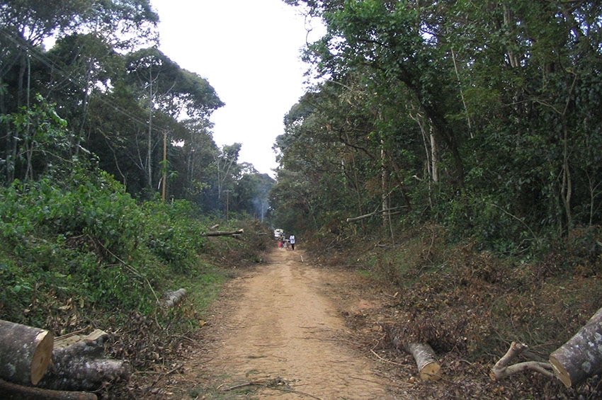
The ecosystem faces many direct and indirect challenges and threats mostly associated with human activities. These include illegal logging, charcoal burning, illegal livestock grazing and poaching. Forest fires, either accidental or deliberately set (especially by honey collectors), have destroyed or damaged large tracts of forest during recent dry periods.
The ecosystem is surrounded for the most part by intensive, small-scale agriculture. The low moorland has been severely damaged in recent years.
Forest destruction and degradation is the major threat to the site, through agricultural encroachment, illegal Cannabis sativa gardens, poaching of valuable trees and forest grazing of livestock. Human-wildlife conflict has long been intense around the borders of the National Park salient and the forest reserves.
Marauding animals regularly damage crops, and occasionally kill or injure people. On the moorland, the status of two of the threatened species - Sharpe's Long claw and Aberdare Cisticola - remains little known, and needs investigation(UNESCO,2010)
Gazetted forests are hampered by inadequate resources such as transport, funding and personnel. With the ban on the Non Residential Cultivation (NRC) in the early 1990’s and KFS’ lack of requisite human capacity to establish plantations, the end result has been backlogs in planting, weeding, poor plantation establishment and losses from game damage.
Tourism development in Aberdare is hampered by poor infrastructure, uncontrolled entry into the ecosystem, visitor security and lack of equitable benefit sharing among the stakeholders in the tourism sector (KWS Aberdare ecosystem Management plan 2010-2020)
Conservation efforts in the Aberdares
KWS Aberdare ecosystem Management plan 2010-2020 spells out biodiversity restoration and protection plans and ecosystem conservation efforts, comprising of -carrying out a feasibility study for elephant corridors through easements; strengthening existing monitoring systems and conducting priority research to provide information for adaptive management and protection of elephants and critical habitats; investigating impacts of predators on Black rhino; monitoring and protecting the status of the Black rhino population in the AE; collaborating with other stakeholders to enhance Bongo surveillance; evaluating the impacts of bush meat poaching on ungulate species; establishing the population status of carnivores in the ecosystem; carrying out a study on hyena-prey relationships; collaborating with other stakeholders to minimize siltation of Lake Ol Bolossat and downstream dams; and nominating the AE as a UNESCO Man and Biosphere Reserve.
The Kenya Forest Service (KFS) has additionally instituted Natural Forest Management Programme that addresses the threats that are impacting on the most important ecological features in the ecosystem, by; carrying out natural resource assessments; regulating utilisation of non wood forest products; establishing livestock carrying capacity; controlling charcoal burning and illegal logging; developing and implementing a forest restoration action plan; carrying out enrichment planting and lobbying for harmonisation of conflicting policies e,g. the forest act which allows grazing while water act advocates for protection of the water catchment.
The Farm Forestry management Programme aims at promoting farm forestry to increase tree cover for sustained timber, wood fuel, non-wood forest products and environmental conservation. As such, KFS has established a farm forestry programme to support farmers raise trees and forest products in their farms to ease pressure on gazetted forests. The KFS offers extension services in the influence zone through technical assistance to communities on nursery establishment, and advising farmers on suitable species for farm forestry, tree planting techniques and tree husbandly. This is according to KWS Aberdare ecosystem Management plan 2010-2020.
Citations
Hoiberg, Dale H., ed. (2010) Abedare Range. Encyclopædia Britannica. I: A-ak Bayes (15th ed.). Chicago, Illinois: Encyclopædia Britannica Inc. p. 27. ISBN 978-1-59339-837-8.
UNESCO. (2010) Aberdare Mountains. Available from: https://whc.unesco.org/en/tentativelists/5506/[, [Accessed 3 Feb 2019].
KWS Aberdare ecosystem Management plan 2010-2020 Available from: http://www.kws.go.ke/sites/default/files/parksresorces%3A/Mt.%20Kenya%20Ecosystem%20Management%20Plan%20%282010-2020%29.pdf[Accessed 3 Feb 2019].
The Aberdare Mountain Ranges (Nyandarua Range), Africa: www.bootsnall.com . Rees. Melinda. [Accessed 2 Feb 2019].
The standard (200)Secrets of old tree that was Mau Mau Post Office. Available from https://www.standardmedia.co.ke/article/2000010787/secrets-of-old-tree-that-was-mau-mau-post-office[Accessed 5 Feb 2019].
Kenya wildlife Service [Accessed 4 Feb 2019].
Karangi NM( 2008) Revisiting the roots of Gĩkũyũ culture through the sacred Mũgumo tree.MM Karangi - Journal of African Cultural Studies, 2008 - Taylor & Francis\
https://africageographic.com/blog/kikuyu-elders-ask-tree-for-forgiveness/
Nakaegawa T., Wachana C. and KAKUSHIN Team-3 Modeling Group. (2012). "First impact assessment of hydrological cycle in the Tana River Basin, Kenya, under a changing climate in the late 21st Century," Hydrological Research Letters, 6, pp. 29-34.
Paukwa: Available from https://www.paukwa.or.ke/nyandarua/ [Accessed 2 Feb 2019].


